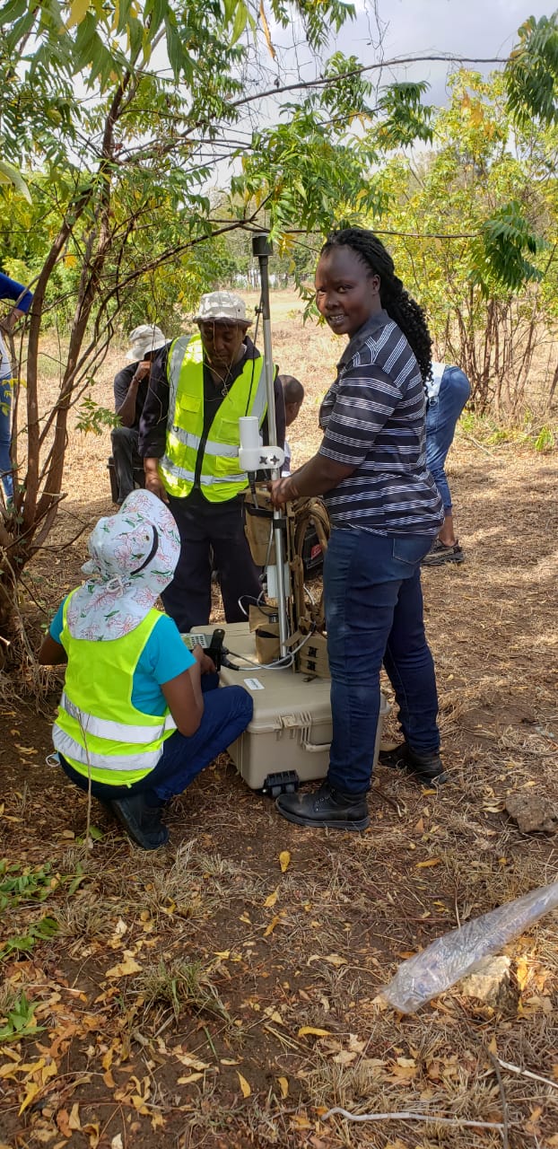
Directorate of Petroleum dispatches Petroleum officers to Lamu Basin to prospect for oil and Gas
The Directorate of Petroleum in the Ministry of Petroleum and Mining has deployed a team of Geo-physicists to undertake a preliminary mapping for prospective oil and off shore gas deposits in the Lamu Basin which stretches from the Kenya Somali border to the border with Tanzania.
According to Mr. Zakaria Hoidi, a senior superitedent Geo-physicist in the directorate of petroleum, the team of 34 officers will undertake an intensive inland and offshore mapping to determine the potentiality of the blocks dubbed L16 to help attract investors in the oil and gas sector.
Mr. Hoidi said the 200 square kilometre radius to be covered in the Lamu Basin spans the offshore Coastal zone and open acreage to update the department's geo-scientific data.
“The team comprises geo-physicists and technologists who will undertake acquisition of gravity and magnetic data in Zone 2 of Block 16. The team targets to populate Zone 2 of Block L16 with geo-physical data for geo-physicists and and technologists and Zone 1 with geological and geo-chemical data", said Hoidi
He disclosed that the mapping exercise covers Baricho, Bamba, Kilifi township area, Vitengeni, Mwangea, Lango Baya, Matalani, Matsangoni and Watamu in Kilifi County which is approximately 2000 square kilometres.
The Department, Mr.Hoidi added will spend Sh120 million on the geo-physical and geo-chemical exploration.
The data collected will be fed into the Petroleum Data Base which will be shared with prospective investors in order to reduce the cost of exploration for oil and and reduce the risk of exploration whose brunt is normally borne by the government when prospectors come calling.
Mr. Hoidi further said that most oil and gas blocks are open so it was imperative for the Ministry to generate data on availability of these deposits to attract investors which will in long run benefit the community through Corporate Social Responsibility (CSR).
Mr Hoid added that the Lamu Basin has enormous potential gas and oil deposits which also includes the offshore sea area in the Lamu Archipelago.
“We have deployed very specialized equipment like graphimetres, magnetometres, Transcient ElectroMagnet(TEM) and Magnetic Teturic(MT) to scour the earth surface to pick data for analysis” Hoidi revealed.
He said that the data collected will be used to generate maps which provide information about surface oil and gas deposits.
“What we are doing is not new since it was carried out in the Lokichar area of Turkana County before Tullow Oil took up oil exploration in the area”, Hoidi said.
------

